
Kilpatricks and Burncrooks Reservoir Loop
- Recreational
- Glasgow Running Routes
- 5 August, 2020
Route summary
Starting with a climb up to Jaw Reservoir, this near 13 mile route crosses the boundary into Stirling and loops back via the Kilpatrick Hills including Duncolm, The Slacks and the many reservoirs.
- Off-Road
- 12.7 miles
- 1765 ft
- 1755 ft
Elevation profile

Get route
Share route
Route information
The Kilpatrick Hills are roughly 9 miles from the city centre and their easy access makes it popular with mountain bikers, walkers, and runners, although it’s often quiet and it can feel like you have the whole place to yourself. The route crosses into the Stirling boundary and can be extended to join up with the Whangie route.
Plenty of hills and water features to keep you entertained including:
- Jaw Reservoir/Cochno Loch
- Kilmannan and Burncrooks Reservoirs
- The 3 Duncolms
- Loch Humphrey
- The Slacks
- Greenside Reservoir
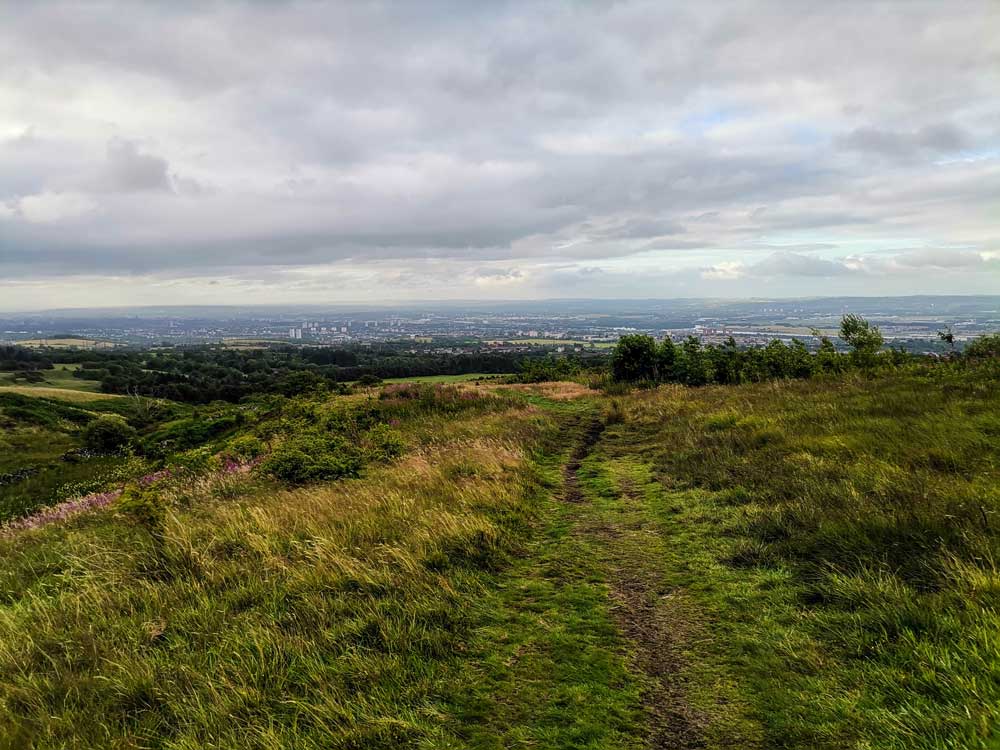
If travelling by car, park at the Auchnacraig Car Park on Cochno Road (Google Maps). From the car park, take a right then follow the road and signs for the path to Jaw Reservoir. It’s a mixture of grass and stoney paths as you head up the hill for one mile to reach the reservoir. Even at this early stage of the run, looking back as you make your way to Jaw gives you great views over Glasgow and Clydebank.
Follow the path alongside the reservoir, cross at Cochno Loch and run the path up past the fishing hut and onto the forestry tracks. The stoney roads last for about 3 miles as you run round Kilmannan then Burncrooks Reservoir. There’s a big stile to get over as you cross Burncrooks then a short climb as you leave it. Instead of following the main path at the other side of the reservoir, keep a look out for the grassy path on your right – it’s easy missed, if you reach a gate you’ve gone too far.
Duncolm is the highest point in the Kilpatricks but this route leaves it’s climb for another day. The run towards and around it can be very boggy then it’s a short steep climb up and over Middle Duncolm. The run down to Loch Humphrey is then a mixture of grass, bog and more defined paths. It can be especially muddy at the forestry commission gates.
After Loch Humphrey, take a left up the grassy embankment and run the path along the perimeter fence and onward to the trig point at The Slacks. From there, you follow the well trodden paths down to Greenside Reservoir, past Cochno Hill and back to Jaw before retracing the route back to the start.
I would recommend a pair of trail shoes for this route, however road shoes would be fine if there has been a spell of dry weather. As with other runs in the hills, make sure you’re prepared for the conditions and potential changes in the weather.
Gallery
Add your images to this route.
Email glasgowrunningroutes@gmail.com and include the name of the route.
Reviews
{{ reviewsTotal }}{{ options.labels.singularReviewCountLabel }}
{{ reviewsTotal }}{{ options.labels.pluralReviewCountLabel }}
{{ options.labels.newReviewButton }}
{{ userData.canReview.message }}
Route description
Gallery
Reviews
The Kilpatrick Hills are roughly 9 miles from the city centre and their easy access makes it popular with mountain bikers, walkers, and runners, although it’s often quiet and it can feel like you have the whole place to yourself. The route crosses into the Stirling boundary and can be extended to join up with the Whangie route.
Plenty of hills and water features to keep you entertained including:
- Jaw Reservoir/Cochno Loch
- Kilmannan and Burncrooks Reservoirs
- The 3 Duncolms
- Loch Humphrey
- The Slacks
- Greenside Reservoir
If travelling by car, park at the Auchnacraig Car Park on Cochno Road (Google Maps). From the car park, take a right then follow the road and signs for the path to Jaw Reservoir. It’s a mixture of grass and stoney paths as you head up the hill for one mile to reach the reservoir. Even at this early stage of the run, looking back as you make your way to Jaw gives you great views over Glasgow and Clydebank.
Follow the path alongside the reservoir, cross at Cochno Loch and run the path up past the fishing hut and onto the forestry tracks. The stoney roads last for about 3 miles as you run round Kilmannan then Burncrooks Reservoir. There’s a big stile to get over as you cross Burncrooks then a short climb as you leave it. Instead of following the main path at the other side of the reservoir, keep a look out for the grassy path on your right – it’s easy missed, if you reach a gate you’ve gone too far.
Duncolm is the highest point in the Kilpatricks but this route leaves it’s climb for another day. The run towards and around it can be very boggy then it’s a short steep climb up and over Middle Duncolm. The run down to Loch Humphrey is then a mixture of grass, bog and more defined paths. It can be especially muddy at the forestry commission gates.
After Loch Humphrey, take a left up the grassy embankment and run the path along the perimeter fence and onward to the trig point at The Slacks. From there, you follow the well trodden paths down to Greenside Reservoir, past Cochno Hill and back to Jaw before retracing the route back to the start.
I would recommend a pair of trail shoes for this route, however road shoes would be fine if there has been a spell of dry weather. As with other runs in the hills, make sure you’re prepared for the conditions and potential changes in the weather.
{{ reviewsTotal }}{{ options.labels.singularReviewCountLabel }}
{{ reviewsTotal }}{{ options.labels.pluralReviewCountLabel }}
{{ options.labels.newReviewButton }}
{{ userData.canReview.message }}
Latest routes

7 More West End Hills
17 September 2023

Mini Southside Six
30 January 2023

ACORN South By Five: Queen’s Park 2023
22 January 2023
Donate
and help keep Glasgow Running Routes online
Latest articles

Top 10 Lockdown Routes
15 September 2020

Running Routes in Scotland
7 September 2020

Popular running routes – 2019
7 September 2020

How to quickly and easily create a route using Garmin Connect
20 February 2019